
The Intelligent Water Supply dashboard is meticulously designed for optimal user interaction and data representation. At the forefront of the interface, the upper left section of the screen prominently displays the coordinates for the vehicle's central point. This feature is not only intuitive but also enables a seamless exploration of detailed geographical data. By selecting these central point coordinates, users can activate an expansion to reveal the coordinates of an additional 5,000 points, systematically organized on the right side of the interface. This innovative approach ensures precision and ease of access to critical data points, enhancing the overall user experience and operational efficiency of the water supply system.
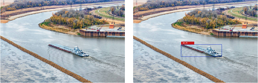
The water service robot is equipped with advanced location and tracking capabilities, designed to monitor and engage with multiple targets simultaneously. Within its operational purview, the robot successfully identified four cargo ships, showcasing its exceptional surveillance capacity. These identified vessels are not only tracked but their coordinates are dynamically illustrated on a three-dimensional map generated in real-time by the system. This innovative feature provides a comprehensive and interactive view of the operational area, enhancing situational awareness and facilitating precise navigation and management tasks in complex maritime environments.
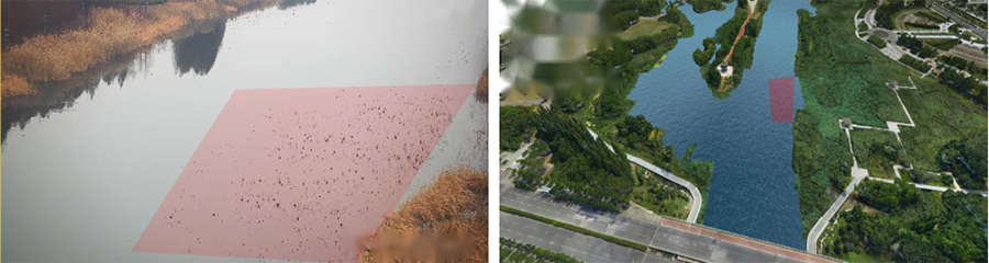
The system introduces a cutting-edge approach to algae identification, employing a dual-screen setup for enhanced accuracy and user engagement. On the left, a live video feed presents real-time visual monitoring, while on the right, the precise location and region of algae are pinpointed within a four-dimensional space-time map. This innovative integration not only facilitates the immediate detection of algae but also offers a detailed analysis of its spatial and temporal distribution, providing a comprehensive tool for environmental monitoring and management.
"Three Lines and One Road" Environmental Protection employs a state-of-the-art four-dimensional space-time map, designed to autonomously identify environmental violations and illegal structures. This advanced mapping technology integrates spatial and temporal data, allowing for the proactive monitoring and pinpointing of infractions within protected areas. It serves as a crucial tool in safeguarding our environment, enabling efficient enforcement and preservation efforts in real-time.
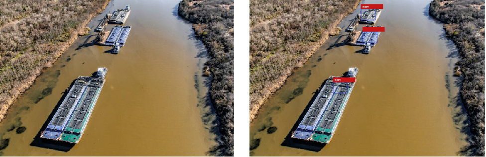
Left Image: Displays the ships that have been identified, providing a clear visual representation of each vessel.
Right Image: Shows the precise coordinate positions of the identified ships on the map, offering a detailed geographical overview.
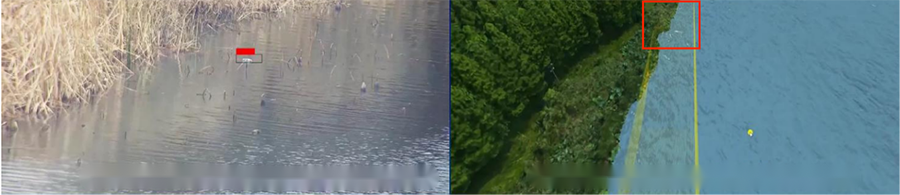
Left Image: Showcases the identified floating object, pinpointing its presence with precision.
Right Image: Depicts the floating object's space-time position on a four-dimensional space-time map, offering a comprehensive view of its trajectory and location dynamics.
Left Image: Identifies individuals within the frame, capturing and highlighting their presence effectively.
Right Image: Illustrates the pedestrian's coordinates on a 3D map, offering a detailed spatial representation.
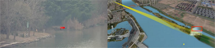
Left Image: Showcases the identified floating object, pinpointing its presence with precision.
Right Image: Depicts the floating object's space-time position on a four-dimensional space-time map, offering a comprehensive view of its trajectory and location dynamics.
Left Image: Illustrates the distribution of the underground pipe network, providing a clear overview of its layout.
Right Image: Details the diameter, material, and fluid movement within the pipes at any given location in the underground network, offering in-depth insights into its structure and functionality.
The latest news, articles, and resources, sent to your inbox weekly

With a focus on sustainability and efficiency, DGMY stands at the forefront of digital technology. Our array of products and solutions are meticulously designed to meet the dynamic needs of our users while contributing to a greener, more sustainable future for our planet.


