
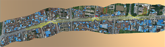
Our Intelligent Transportation system sets a new benchmark in vehicular monitoring and management, leveraging a sophisticated four-dimensional space-time map that identifies and positions all vehicles within the territory with unparalleled precision. Each vehicle is tracked 25 times per second, ensuring road lateral positioning accuracy at the centimeter level and road longitudinal positioning accuracy at the sub-meter level.
This cutting-edge system comprehensively addresses the entire spectrum of smart road requirements—from current operational demands and application innovations to future development aspirations—at a cost that undercuts all existing systems in the market. Our solution not only represents a leap forward in intelligent transportation technology but also establishes a new standard for affordability and efficiency in smart road infrastructure.

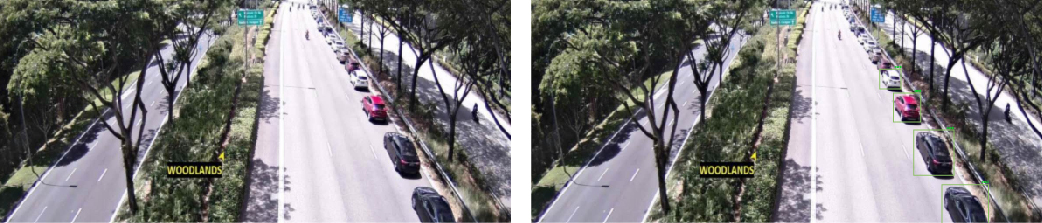
Spatiotemporal accuracy of all moving targets in the right figure: 3 D geodetic spatial accuracy cm level;
temporal precision: 25 times / s.
The six video streams on the left are synchronously converted into a four-dimensional space-time map generated by the fusion of the four-dimensional space-time image collection and the three-dimensional real scene map.


The latest news, articles, and resources, sent to your inbox weekly

With a focus on sustainability and efficiency, DGMY stands at the forefront of digital technology. Our array of products and solutions are meticulously designed to meet the dynamic needs of our users while contributing to a greener, more sustainable future for our planet.


